Album: Yarrow Pioneers: Vedder River Flats and Majuba Hill, British Columbia
Friends 1 | Friends 2 | Friends 3 | Friends 4 | Friends 5Holidays 1 | Holidays 2 | Holidays 3 | Holidays 4
Family 1 | Family 2 | Family 3 | Family 4 | Family 5 | Family 6 | Family 7 | Family 8 | Family 9
Yarrow Days | Yarrow Scenes | Yarrow Pioneers: Vedder River Flats & Majuba Hill | Vancouver Views | Victoria Times
Yarrow Elementary Junior High | Yarrow Junior High 1953-57 | Junior High Student Council | Yarrow Friends
1994 School Reunion 1 | 1994 School Reunion 2 | 1994 School Reunion 3 | 1994 School Reunion 4
Vedder River | Vedder Mountain
UBC Reunion | Critical Paths | Mug Shots
Yarrow Pioneers: Vedder River Flats and Majuba Hill
Yarrow, British Columbia
Yarrow Pioneers
Vedder River Flats and Majuba Hill
by
Chester Brown and Elmer Wiens
An excerpt of this page is reprinted on the web page of the Vancouver Sun in its BC150—Celebrating Our Diversity—series.
|
Historically, people of the Sumas (Sema:th, Sum-Aht) and Chilliwack (Ch.ihl-kway-uhk, Chilukweyuk) tribes of the Stó:lo and Tzeachten Salish First Nations resided in the region around Sumas Lake. The Chilliwack traded and affiliated with the Salish tribes on the Nooksack River of Washington State by way of the Old Nooksack trail meandering between Vedder Mountain and Sumas Lake, and by way of Columbia Valley and Cultus Lake. Sumas, Stewart, Street, Vedder, and Lewis Creeks, plus numerous Vedder and Sumas Mountain streams flowed into Sumas Lake, drained by the Sumas River to the north into the Fraser River. During the spring and early summer snow melt, Sumas Lake flooded and expanded, diminishing in size in the fall and winter seasons. Vedder Mountain, and the Fraser River and Sumas Mountain confine the region to the south and north. The white, snowy precipices of Mount Cheam and Mount Baker stand out to the east and southwest.
The area occupied by Sumas Lake expanded after 1875, when a logjam blocking the Chilliwack River's route through Sardis diverted some of its flow into Vedder Creek. Sumas Lake's extent expanded again after 1882, when the headwater of the Chilliwack, Luckakuck and Atchelitz streams on the Chilliwack River was blocked, causing all the Chilliwack's water to flow into Vedder Creek, later known as the Vedder River. Before 1882, the Chilliwack River twisted to the right at Vedder Crossing, continuing as the Chilliwack River through Sardis toward the Fraser River. After 1882, it curved left to overwhelm Vedder Creek, known as the Vedder River below the Vedder Crossing Bridge.
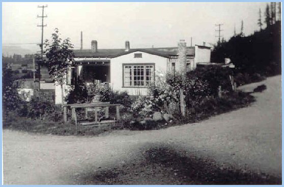
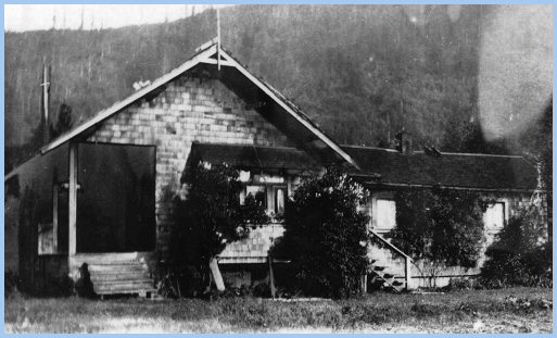
Settlement of the area by Europeans accelerated with the arrival of the Hudson Bay Company's traders (circa 1800), the Cariboo Gold Rush (circa 1858), the construction of the Collins Overland Telegraph line (1865), the Colony of British Columbia joining Canada (1871) as a province, the incorporation of the Municipality of Chilliwhack (1871), the completion of the B.C. Electric Railroad from New Westminster to Chilliwack (1910), the Sumas Lake Reclamation project (1924), and Mennonite immigration into Yarrow (1928). The Vedder, McGillivray, and Chadsey families were early settlers (circa 1860's) to the region. After their Cariboo gold-rush days, Volkert Vedder (1808-1898) and his sons, Adam and Albert, owned up to 1,200 acres of land to the east and south, and adjacent to Sumas Lake, known as the Vedder Ranch. Adam Vedder (1834-1905) was a Member of the Provincial Parliament, and served as Warden of the Township of Chilliwhack. Donald McGillivray (1838-1913) farmed 800 acres on Sumas Prairie until 1903, after which he moved to Chilliwack. He was a Member of the Provincial Parliament, and served as Reeve of the Municipality of Chilliwhack. William (1843-1906) and Mary Jane (1845-1936) Chadsey were among the first settlers on Majuba Hill. During the gold rush, William and his brother, James, shipped hermetically sealed cans of butter to the Cariboo gold fields from their Chilliwack and Sumas area farms. Following this successful venture, they built and operated the first flour mill in the Chilliwack area. After the 1894 Fraser River flood, the Chadsey's built and occupied homes on Majuba Hill. From 1900 to 1910, William and his son Lockhart served as postmasters of the Majuba Hill Post Office (Coutts 109-110). James Hounsome succeded Lockhart Chadsey as postmaster. In 1912, Hounsome relocated the post office from Majuba Hill to his house north of Yarrow Station, on the shore of Sumas Lake. On January 1, 1914 this Post Office was renamed to Yarrow. In 1927, William and Ella Siddal (1885-1976) followed Hounsome as postmaster. They had built a "house and store south of Yarrow Station" in 1920, on the mountain side next to the railway tracks (Coutts 112). The picture below shows Siddall's store, post office, and house south of the BCE railway tracks at Yarrow Station, with Yale Road on the right and Wilson Road heading north on the left. The telephone poles in the background run next to the BCE Railway tracks. The footbridge in the foreground crosses the spillway creek from the Yarrow Reservoir, which flowed along the east side of Wilson road to join Stewart Creek. For many years, salmon spawned here, arriving from the Fraser River by way of the Sumas River and Stewart Creek.
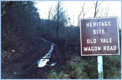
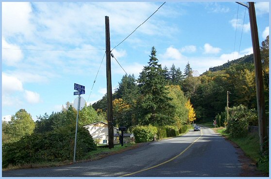
Today, the Majuba Heritage Park is situated on the site of Sidall's house, store, and post office. Yale Road is now the Heritage Site called the Old Yale Wagon Road that runs along the foot of Vedder Mountain to Vedder Mountain Road.
Majuba Hill consisted of the bench on Vedder Mountain situated south of Sumas Lake, and bisected by the Yale-Westminster Highway. Begun in 1865 and completed in 1875, this highway continued to the north to cross Vedder Creek by way of a bridge, and to the west to skirt Sumas Lake on its way to Fort Langley. Sometime around 1885, Frank and John Lumsden acquired the Vedder Ranch. The brothers incurred financial difficulties when their project to drain Sumas Lake proved unsuccessful. Apparently, John Sampson (1858-1940) leased the Vedder Ranch (circa 1895), living at the Vedder's homestead house, and sharing title to the property with the British Columbia Land and Investment Company. Circa 1898, the British Columbia Land and Investment Company obtained full title to the Vedder Ranch, which they held until 1905. In 1905, Joseph Knox (c. 1857 - 1931) and Margaret Knox (1845 - 1910) procured the ranch. Circa 1908, Knox sold to Ernest Crain and Chauncey Eckert a large portion of his farm west of Yale Road (Wilson Road), which at that time proceeded due north to the Vedder River from the eastern extremity of Majuba Hill.
The B.C. Electric Railway, completed in 1910, divided what came to be Yarrow: "Yarrow Proper" west of the tracks up to Boundary Road, the "Vedder River Flats" east of the tracks and north of Vedder Mountain up to the Vedder River, and "Majuba Hill" south of the tracks on Vedder Mountain. Affectionately or derisively depending on one's point, the Vedder River Flats were known locally as "The Bush." Today, properties on Majuba Hill are prized for their views; then, settlers preferred the productive farms on the plain of Yarrow and Sumas Prairie. While the settlement of "Yarrow Proper" waited for Sumas Lake to be drained in 1924, the settlement of the "Vedder River Flats" was facilitated by the relocation of the Yale-Westminster Highway (c. 1908 - c. 1920) along Vedder Mountain from Majuba Hill to Vedder Crossing. This new road next to the mountain was known at first as Yale Road, and subsequently as Vedder Mountain Road.
Yarrow Pioneers: Vedder River Flats
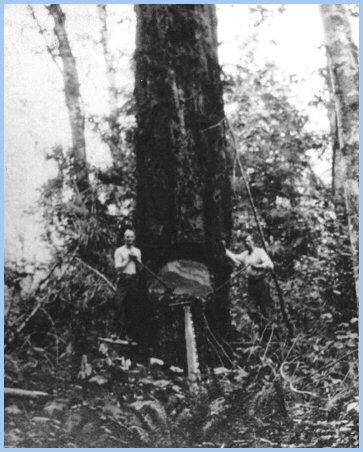
The land east of Sumas Lake, overshadowed by Vedder Mountain, cut and ravaged by the Vedder River, was a rugged area. During the late summer, fall, and early winter, sizeable runs of spawning salmon invaded Sumas Lake, the Vedder River, and their tributary creeks, joining resident fish that included nimble cutthroat and rainbow trout, lissom whitefish, indolent olive green dolly varden, tiny prickly minnows, bristly languid suckers, and huge scavenging Pacific sturgeon. Vast flocks of geese and ducks, and occasional groups of trumpeter swans populated Sumas Lake, while pheasant and grouse inhabited the thickets of pussy willows, poplar trees, and blackberry bramble patches. Deer, bear, coyote, bobcat, and cougar roamed the mountainside and flats covered by hefty cottonwood, maple, hemlock, fir, and cedar trees.
Click on the photograph for a larger version!
Travelling west from Vedder Crossing one passes a few farms lying between the highway and the Vedder River. Then, one encounters Ford Road, Browne Road, and Martin and Simmons' Road jutting from Vedder Mountain Road and Vedder Mountain. Browne Road and Ford Road, proceeding due north to the Vedder River, are joined by the barely discernible Duncan Road. Browne Road and Martin and Simmons' Road share a junction off Vedder Mountain Road. Martin and Simmons' Road, later known as Lumsden Road, runs due west, ending at the BCE Railway tracks near its Vedder River bridge. Bergman Road juts north to the Vedder off Lumsden Road, while Simmons Road juts south to the mountain. Knox's farm consists of the rectangular area east and next to the BCE Railway tracks. Emails and letters exchanged with Chester Brown depict with text and photographs many of the early settlers of Majuba Hill and the Vedder River Flats. Pioneers cleared these lands to develop farms for livestock and produce.
Chester Brown writes, "To the east of Yarrow, a dozen or so families lived on the Browne and Ford Roads, and a few more along the Yale Road east of Ford Road as far as Vedder Crossing, about three and a half miles from Yarrow. The one-room Vedder Mountain School served these families until 1926, when it was closed. For the 1926-1927 school year, these children were trucked, first to Majuba Hill for a half term, and then to Atchelitz School. From 1927 to 1929, students in grades 6 through 8 from Majuba Hill and east along Yale Rd were trucked to Sardis School. Starting in 1928, younger students from Majuba Hill attended the new Elementary School located at the south-west corner of present day Yarrow Park."
The farms of the pioneers of Vedder Mountain Flats were located along Martin and Simon's (Lumsden), Browne, Duncan, and Ford Roads, and east of Ford Road along Vedder Mountain Road The Abe Simmons and Jack Martin families owned farms on their road.
Mrs Simmons was the sister of Rosa Martin and Jack Martin.
Hudson Family Edward (c. 1865-1940) and Esther Hudson (1869-1956) were early pioneers, who cleared land on Duncan Road and built a house. To the west, a wagon road connected the Hudsons to Majuba Hill and Yarrow Station. This wagon road continued east to Ford Road which proceeded north to the Vedder River, possibly crossing the river by way of a gravel ford to connect with Lickman Road in South Sumas (Greendale) north of the river.
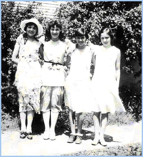
— Photographs Courtesy of Donald Hudson — Being somewhat isolated, the young people of the Vedder River Flats and Majuba Hill, generally socialized amongst themselves in homes, or at parties and dances in the Vedder Mountain and Majuba Hill Schools.
Chester Brown states, "Mother's uncle Edward Hudson married Esther, his bride from London, in 1907 in Vancouver, and they had a son, also named Edward. The Hudsons bought 15 acres off what later became Browne Road south of a wagon road, near Yarrow, sometime in the early to mid 1910's. They sold the property and moved away in the early 1920's. Edward junior married and had two sons, Donald and Gordon. They had successful professional careers, and are now retired now on Vancouver Island."
Brown Family Chester Brown writes that his father, Ernest William Browne, was born in Shropshire in 1871, and in 1889 immigrated alone to Vancouver, Canada, working at whatever he could find for some years. He changed his name to Robert Brown because of the disfavour Englishmen faced in the job market at that time (his name sounded and looked just too English), started working on coastal boats around the turn of the century, and obtained his Master Mariner certificate in 1907. He skippered tugboats out of Vancouver as Captain Brown until 1930, when the economic depression and his ill health forced him out of work permanently.
"My mother, Elizabeth Hudson, was born in London, England in 1883, serving a long apprenticeship as a seamstress / fitter / tailor. She immigrated to Vancouver with her uncle, Edward Hudson, in 1907, where she met Dad. They married in December 1908. She worked at her trade until my sister, Annetta, was born in 1917." "In 1918, my parents, Robert and Elizabeth Brown, bought 15 acres on Browne Road, immediately south of Duncan Road (then only a wagon road), and west of the Hudson's homestead. Soon after this purchase, through a long-term payment agreement with the Soldier Settlement Board, they bought the adjoining 20 acres to the south, next to Browne and Yale Roads. They cleared a few acres on the 15-acre parcel and built a tiny house, to which they added over the next few years."
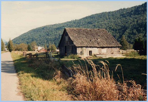
"The barn my father built in the 1920's beside what is now Duncan Road was still standing in 1982, a testimony to good workmanship."
"Because Dad's work was based in Vancouver, my mother raised two kids, kept a cow, a pig, chickens and a large garden all on her own — an amazing achievement for a woman raised in London with no rural experience!"
"Our neighbours in the earliest years included the Duncans, across the wagon road (Duncan Road) and immediately north of us; Hudsons, directly east of us; Mortons, east of Duncans; George Rowtasch, the Swiss farmer, west across Browne Road; Martins and Simmons on the neighbourhood's largest farms on their road (now Lumsden Road); and Latties south of Yale Road at Browne Road junction. Later, the Currence family bought Latties; Nickels bought Duncans; Johnsons bought Hudsons; Downings bought the property north of Duncans; and Nowells bought west of George Rowtasch. Roy Rexford built a little house in the "V" between Yale Road and Martin and Simmons' Road."
"In 1930, we moved to the Johnson's (Hudson's) 15-acre property, which we bought for $5000. The house built by my mother's uncle, Edward Hudson Sr., was situated south of the "S" curve of Duncan Road. Our friends included classmates from the Majuba Hill and other area schools that my sister, Annetta, and I attended. From among our circle, Margaret Maitland and Annetta remained fast friends throughout their lives."
"In 1931, we sold the 15-acre Browne Road property to a Mennonite family. The 20-acre property's ownership, at Browne Road junction, reverted to the Soldier Settlement Board in 1935."
Chester Brown writes, "The BC Electric Railway was completed in 1910 to provide passenger and freight transport from Vancouver / New Westminster to Chilliwack, and beyond to the Fraser River and the old Yale Road. There were stations at Yarrow and Belrose on both ends of Majuba Hill, and a flag stop south of the Vedder River Bridge at the end of Martin and Simmons' Road. To shop in Chilliwack, we flagged the BC Electric Interurban train.
"Usually, we shopped for day-to-day staples in Yarrow at Bill Siddall's store, at Yarrow Station along Yale Road."
"For my first year of High School in Chilliwack, I lived in a house owned by the Maitlands in Chilliwack. Parents of Yarrow students staying in this house rotated in providing care for us. Thereafter, I cycled the ten miles to Chilliwack from Duncan Road, regardless of the weather. The road to Chilliwack could be dangerous. On one occasion on my way to school, a car driven by someone travelling to Vedder Crossing from Chilliwack struck me in Sardis, and I spent some time recovering from my injuries in the Chilliwack General Hospital. However, I persevered to get my education, despite the hazards presented by inclement weather, road conditions, and careless drivers." "Yale Road traversed the valley west of Sumas Lake, crossed the BCE rail line a mile or so southwest of Belrose Station, followed the lower slopes of Vedder Mountain to a half mile east of Yarrow, and then continued along its present route next to the mountain to Vedder Crossing. This road provided the only overland, road route up the Fraser Valley south of the river."
"Even after the Vedder Canal Dykes were built in 1924 and Sumas Lake was drained, Sumas Prairie was subject to flooding."
When an ice storm cut the power lines in 1935 to the Sumas pump-station, much of Sumas Prairie was flooded with disastrous consequences for the crops of tobacco. The two biggest players on Sumas Prairie, the Canadian Tobacco Company and the Totem Tobacco Company, were put out of business. In 1936, a group of small tobacco farmers formed the Sumas Tobacco Growers Co-operative Association, selling its tobacco leaf to Imperial Tobacco of Eastern Canada (Sleigh 69-72). Chester Brown writes, "In 1935, I moved to the Okanagan. My parents lived in Yarrow until 1938, after which they moved to Burnaby. My sister, Annetta, changed her name to Adrian, trained as a nurse in New Westminster, and married an electrical engineer by the name of Alton Hurt. After serving with the Canadian Navy during the war in the Pacific and Eastern Mediterranean Zones, I attended U.B.C.
Having obtained a degree in geography at U.B.C., I worked in Saskatchewan for a while. After I married, I worked for the federal government in Ottawa until my retirement in 1976."
Derksen—Wiens Family In 1928, Mennonite settlers arrived to purchase parcels of land Chauncy Eckert subdivided from his Knox Farm purchase. Many of these settlers came from farms on the provinces of Alberta, Saskatchewan, and Manitoba.
As the availability of lots from Eckert's Yarrow subdivision diminished, settlers spilled onto the Vedder River Flats and up Majuba Hill, acquiring existing farms or subdivided acreage. Elmer Wiens writes, "In 1929, four of my Grandfather Julius Derksen's brothers, Johann, Henry, Gerhard, and Peter, lived in Yarrow. Meanwhile, my grandparents and their children worked their wheat farm in Blumenhof, Saskatchewan, south of Swift Current."
"In 1936, the Derksen family relocated to Yarrow, acquiring property on the west side of Ford Road (Giesbrecht Road) contiguous to the Vedder River."
The Derksens raised chickens, milked dairy cows, and grew potatoes, corn, and berries on their Vedder River farm. The family income was supplemented with work in the hop yards and tobacco fields on Sumas Prairie. During the 1930's and 40's, many young women of Yarrow lived and worked in Vancouver as care givers and domestics, commuting home to Yarrow by way of the BC Electric Interurban trains. For a while, Katie Derksen worked as a nanny for a "wealthy Eaton family."
Elmer Wiens continues, "My Aunt Sara married George Siemens on March 28, 1937 in the Yarrow, MB Church. After farming in Saskatchewan for a few years, Uncle George and Aunt Sally bought the farm east of Browne Road adjacent to the Vedder River, and west of the Derksen farm on Ford Road. My Uncle Jake died on December 30, 1938, and was buried in the Yarrow Cemetery at the end of Alder Road (Hare Road)." "On March 16, 1939 my parents, Katie Derksen and George Wiens, married in the Yarrow MB Church."
George and Katie purchased and operated the twenty-acre farm at the northeast corner of Browne Road and Vedder Mountain Road, formerly owned by Mr Robert Brown. Along with dairy cows, chickens, and hogs, they harvested strawberries, raspberries, potatoes, and corn."
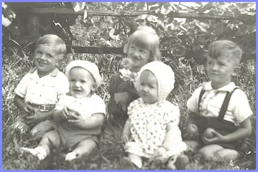
George and Katie's children, Raymond, Elmer, Luetta, and Alfred, enjoyed playing in the barns and fields, and fishing for trout in the salmon stream (Street Creek) flowing through the farm. Chester Brown fondly recalls fishing this same stream during the 1920's and 30's, when the Browns owned the property.
Each fall, the family picked hops on Sumas Prairie, getting up before dawn, returning home in the evening to finish farm chores. Weigh-up-time determined the essence of a day picking hops. The picked hops accumulated in one's basket were dumped into sacks and weighed. This measure of the day's labour was punched onto a ticket, redeemable for money at the end of hop-picking season at the hop-company office.
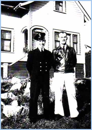
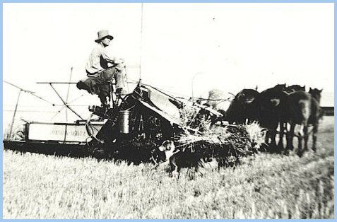
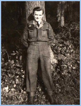
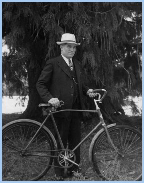
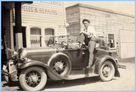
Elmer Wiens continues, "In 1944 my Uncle Julius joined the Canadian Armed Forces. The next two pictures show Uncle Julius in his military uniform visiting my grandparents, and my grandfather preparing to visit someone on his bicycle on Sunday afternoon. The Vedder River can be seen in the background."
"Following the 1946 spring flood, my grandparents moved to Yarrow onto a few acres, just west of the Yarrow MB Church; my Siemens cousins moved to a 100-acre farm on Sumas Prairie.
Today, the Derksen Vedder River farm is the Vedder River Campground, operated by the Cultus Lake Parks Board."
Yarrow pioneers suffered brutal hardships from the flooding of the Vedder and Fraser Rivers ensuing from the annual, spring snow melts on British Columbia's massive mountains. The severe flood in May and June of 1948 was the outcome of a number of concurrent circumstances. Cool weather during the spring delayed the thawing of the substantial accumulation of snow in the mountains until late May. Over the Victoria Day weekend, temperatures spiked, rapidly melting the mountains' snow pack, substantially raising the water levels of the Fraser and Vedder Rivers. At the same time, the moon's position in relation to the earth and the sun (lunar perigee on May 15; full moon on May 22; solar summer solstice on June 21) caused unusually high tides that slowed the flow of the Fraser River, backing up the Vedder River. Consequently between May 28 and June 3, a number of dykes were breached, flooding large tracts of land in the region of the confluence of the Fraser and Vedder Rivers (Lenzmann).
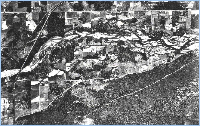
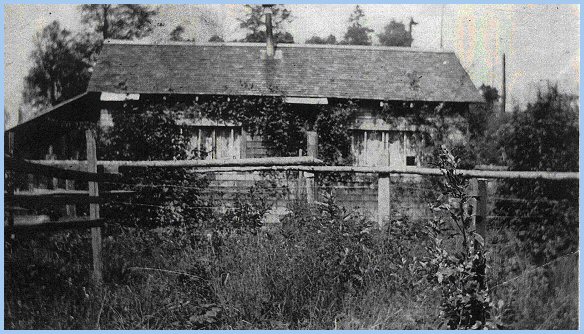
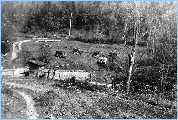
Elmer Wiens writes, "My father built a dam on our creek to irrigate the berry patches, corn fields, and hay pastures. Street Creek was fed by the runoff from Vedder Mountain, and a yearlong spring on the Dyck farm east of us on Vedder Mountain Road. Each fall, various species of salmon spawned in our creek. The coho and steelhead fry remained in the creek for almost a year, while the pink and chum fry left for the ocean soon after hatching." The next aerial photograph reveals the Vedder River Flats north of Vedder Mountain Road and east of Browne Road. One can see the Wiens farm in the lower left, north and east of the Browne Road junction with Vedder Mountain Road. The Bunse family lived on the mountainside south of this junction. Street Creek, edged by trees and blackberry bushes, rambles north of the highway crossing Browne Road between George Rowtasche's farmyard to the southwest and the Wiens farmyard to the northeast. Farther to the north, one can see the original Brown homestead, occupied in 1949 by the Dueck family. East along Duncan Road, one sees the site of the Hudson homestead south of Duncan Road, just before its sharp "S" curve. Here, the Giesbrecht farm was sited north of Duncan Road. Click on the photograph for a larger version!
"There was always something happening on our farm. We could watch Dad milking the cows in the early evening, check out the new chicks in the chicken barn, help gather eggs, peer over the pen railing as the hogs gulped down their victuals, or look for snakes in the lumber pile."
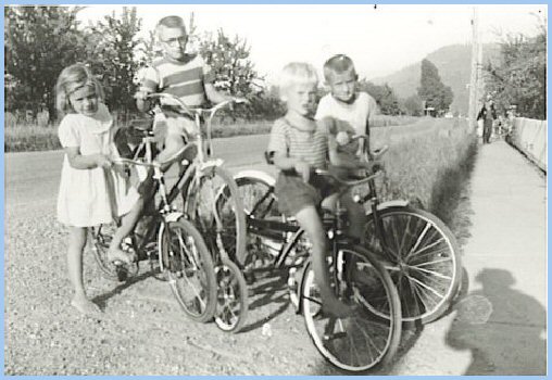
"In the spring of 1953, my parents sold our farm to the Gross family, and we moved to a 3-acre hobby farm in Yarrow at 1012 Central Road, next to the G.G. Baerg family. My mother used the proceeds from the sale of the irrigation equipment from the Browne Road farm to buy each of us children a bicycle."
"That fall, Yarrow School moved to the Pink School on Wilson Road with classes from grades one to nine. On the first day of school, we gathered at the old school in downtown Yarrow, and then we all marched along Central and Poplar Roads to our new school in the morning, Indian summer sunshine. They had painted the doors to the classrooms red, yellow, or blue. My girlfriend, the cute Brown girl who sat beside me at our desk in grade one, and between Rob and me in grade two, didn't return to our school that year. Our grade three teacher until Christmas, Mrs. Sharples, assigned me to sit behind Rita, who always wore such neat belts that year. My lost Roy Rogers lunchbox was replaced by a new Lone Ranger one. It was a wonderful day!"
Yarrow Pioneers: Majuba Hill Siddall Family The next picture shows Wilson Road's junction with Yale Road at Siddall's on the Vedder Mountain side of Yarrow Station, during the 1930's. Knox's farm sits across the railway tracks and to the left (west) of Wilson Road heading due north. Yale Road (Majuba Hill Road) runs to the left (west) and to the right (east). Today, Yale Road running east is a heritage site called the "Old Yale Wagon Road," known locally as "Lovers Lane." The small house seen in the picture just above Siddall's house was known locally as the "Sugar Shack" during the 1960's. Chilliwack Mountain rests in the distant background, south of the Fraser River.
In his history of the Chilliwack area post offices, Cecil Coutts states that Ella (Eva Elmina) Siddal succeeded James Hounsome on the recommendation of Elihu Manuel, a Liberal politician. Bill and Ella's house and store were ideally located for a post office. In 1928, Yale Road was the main highway, and Siddall's store prospered with the influx of immigrants. Eventually, the post office was moved to the "north side of the Siddall home" facing the railway tracks and Yarrow Station (Coutts 111-12).
Yarrow Pioneers lived far away from commercial entertainment in Chilliwack, New Westminster, and Vancouver. A few lines from a poem by Ella Siddall to her friend Elizabeth Brown capture a typical Yarrow Pioneer evening.
William and Ella Siddall's children were Vivian and Arthur.
Bill and Ella Siddall provided postal services from the Wilson-Yale Road junction until 1948, when Bill Siddal built a new Post Office east of the Yarrow Elementary School in downtown Yarrow.
In 1952, John Kehler (1920-1989) assumed the responsibilities of postmaster. Chester Brown writes, "By 1929, Yarrow consisted of a station on the B.C. Electric rail line, a post office, and country store. Yarrow was a community of perhaps a dozen homes with a medical doctor. The Knox farmstead existed in the immediate vicinity, while several families were established on Majuba Hill within a mile west of Yarrow."
Majuba Hill (Hillcrest) School was built in 1903 a half-mile west of Yarrow to serve the Vedder River Flats and Majuba Hill. The building also housed the Hillcrest United Church until WW II (Harms 103-108). After the Hillcrest School closed in 1928, the building served until the mid 1930's as a community hall, with Saturday night dances.
In Yarrow: A Portrait in Mosaic, Agatha Klassen quotes Ella Siddall's recollections of the pioneers of Majuba Hill. John Broe and his family were among the early Majuba Hill pioneers. The Broes cleared land for an orchard and dairy cows, also raising chickens and pigs. The Broes homestead was the "centre of many a lively party for their mountain neighbours."
Ella Siddall writes, "There was a sizeable community that stretched along Majuba Hill on Old Yale Road. There were the Bellrose Family, at the foot of Majuba Hill Road West, and the Towns at the point above Sinclair Siding, the DeGraws, the Dickies, the Mallards, the Golders, the Olsens, the Maitlands, and the Knox Family on Wilson Road South at the foot of Vedder Mountain" (Klassen 108). The members of the Knox family were prominent citizens of the community of Yarrow, built on the one thousand acres of land Joseph and Margaret Knox sold to C.E. Eckert. Joseph and Margaret had two children, George Marshall and Mary Elizabeth.
George Marshall married Henrietta Kirkpatrick; their children were Ethel and Edith. Mary Elizabeth married James Cameron; their children were Muriel and Gordon. Ellas Siddall's poem to her friend Elizabeth Brown describes her visit to her Knox friends and neighbours.
The dwellings of Majuba Hill and Yarrow's pioneers were often rough and ready, constructed from logs and cedar shakes cut from local timber. Lumber was hewn by hand, cut at a small sawmill on Majuba Hill, or brought in by train to Yarrow Station and then dragged by a team of horses to the building site (Klassen 110). Outbuildings were similarly, but more roughly built.
Mennonite settlers who displaced the Majuba Hill pioneers shared a communal focus on the Mennonite churches under the mountain. Much like Vedder Mountain overshadows Yarrow during the winter months, eventually the "Gemeinde" that arose in "Yarrow Proper" from the influx of Mennonite settlers overshadowed the Majuba Hill community in importance.
"For a few decades, however, Majuba Hill was home to a vibrant, close-knit community" (Harms 107).
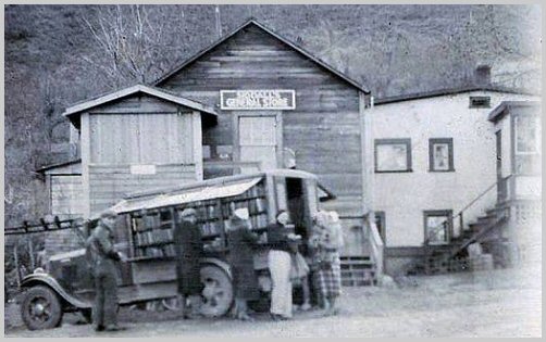
Along with the entrepreneurial Siddall's, Yarrow's farmers and commercial concerns utilized the B.C. Electric Rail Line to bring in commodities, machinery, and equipment, and to ship agricultural products and finished goods. In the early 1940's, C.C. Funk built his Feed Supply Mill east of Siddall's store, adjacent to the tracks across from Yarrow Station.
Sports contribute an integral component to the life of a community. During the 1930's and early 1940's, Yarrow's softball teams played their recreational and league matches on the grounds of the Yarrow School situated in downtown Yarrow. Yarrow's young, pioneer athletes were victorious in many games played on the diamond at the school ground's northwest corner.
While the U.S.A. Prohibition period from 1920-1933 on "the sale, manufacture, and transportation of alcohol for consumption" virtually destroyed the American hop industry, it created a bonanza for Canadian hop growers.
The American Henry Norton Ord, a joint partner of Canadian Hop Yards, and owner of Ord hop fields on Sumas Prairie (Fuggle Hop Garden) and in Kamloops, built a mansion on the western portion of Majuba Hill overlooking Sumas Prairie and western Yarrow.
Chester Brown recalls the Ord family arriving each summer from California in their chauffeur driven limousine for their summer retreat, to join Mr Ord while he managed his Canadian assets. The family of Mrs Ord, Helen Huntington Holladay, had almost a century of experience growing hops. She took over running the company when Henry Ord died in 1955, selling the Sumas fields to John I. Haas, but keeping the Kamloops hop yard (Sleigh 266-67). Numerous young, Mennonite men from Yarrow, who relocated to Kamloops each fall to work in the hop yards, enjoyed their freedom from parental censure in "worldy ways."
Helen and Henry Ord had three children, Edmund, John and Caroline. George and Ann Wasylenchuk (c. 1890-1966) lived on the mountain side across the road from the Ords. Their children were Mary, John, Nick, William, Helen, and Peter.
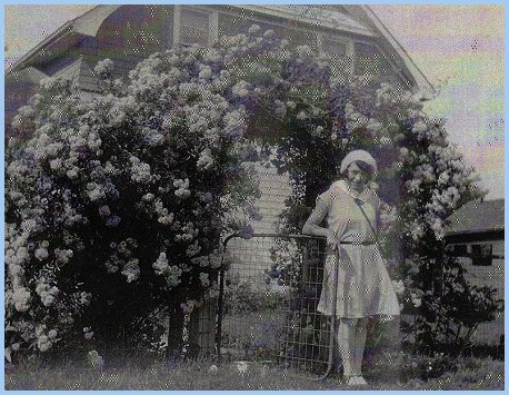
Maitland Family Margaret (Maitland) Bigmore writes, "In 1910, Fred and Mabel Maitland moved from their 5 acre farm in Chilliwack to Majuba Hill, with their three year old daughter, Evelyn. They bought the William and Mary Jane Chadsey farm, with orchards, barns and farmhouse. Mabel (Smith) Maitland's Uncle and Aunt were Chester and Hannah Chadsey. Circa 1918, they sold this farm as soldier settlement land, as soldiers were returning from overseas after World War I, and taking up land."
According to Margaret Maitland, obtained from text provided by Bill Bigmore, her parents in partnership with Herbert Smith (Mabel's father) bought 40 acres farther along Old Yale Road. They cleared about 15 acres, where they built their homes, grew grain, and made pastures for the horses and cattle.
After the B.C. Electric Tram was completed to Chilliwack in 1910, Fred Maitland shipped his milk by rail to Sardis. In the summer, he took his milk cans to the Yarrow station in his car, while in the winter he transported them on a horse-drawn sleigh. The milk from Fred and Mabel's eight cows were cooled by setting the milk cans in a large trough of running water.
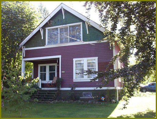
Margaret Maitland concludes, "The old home on Majuba Hill is still there and is occupied! Since 1996 a subdivision has built up around it and everything looks different. Amidst the new surroundings, however, many memories whisper down from the forests of Vedder Mountain looking down on the historic Sumas Prairie."
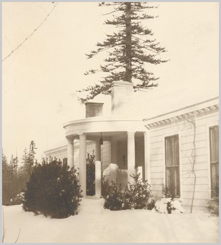
In 2004, Bev Somers, daughter of Evelyn (Maitland) Knowles, took a trip to Majuba Hill with her dad to see her mother's childhood house. She took the following photograph of her mother's childhood house.
Chester Brown writes, "Mrs Porter lived immediately east of Maitlands. She was a World War 1 war widow from Saskatchewan. She had one son Jim, three years older than I. They moved to the U.S.A. I lost touch with them until the early 1990's, when they were living in Anacortes, Washington."
While the Siddall's lived at Yarrow Station, the Belleroses lived at the western extremity of Majuba Hill on their Lake View farm. George Bellerose (1845-1918) built the farm house that served as the Belrose post office after the BCE Railway was completed, with George as postmaster from 1912 to 1918. George's wife, Elizabeth (1850-1952), lived at Lake View farm until her death in 1952 at the age of 101. Their children were Vincent, George, Ernest, and Lulu.
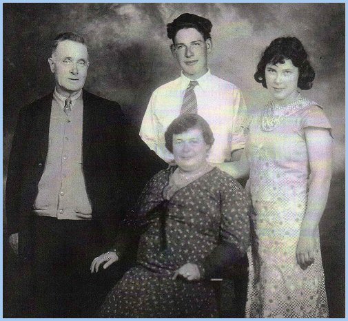
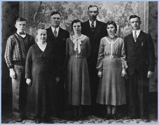
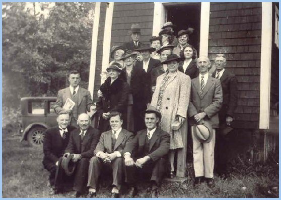
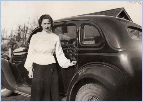
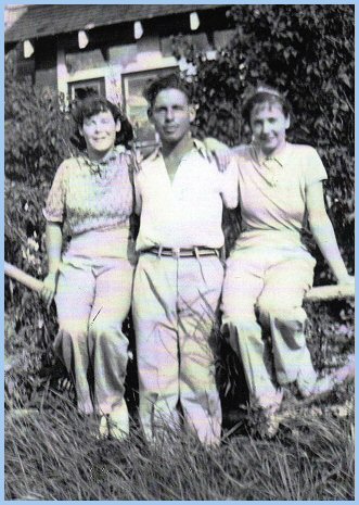
Chester Brown continues, "In 1982, Margaret Maitland and I organized a small get-together of former Yarrow people for a drive from Vancouver to Yarrow and Cultus Lake. Our group consisted of my sister, Adrian Hurt (formerly Annetta Brown), Margaret Bigmore (Maitland), Vivian Parker (Siddall), Edward Hudson, Marian Rexford, and myself."
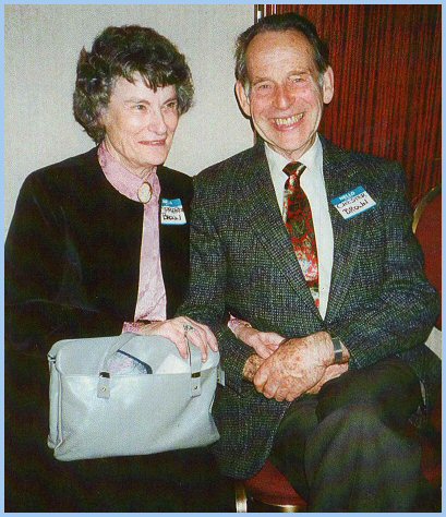
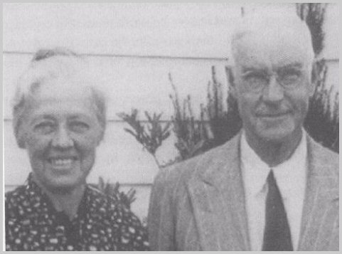
Chester Brown concludes, "The next picture of my sister, Adrian Hurt, and I was taken a few years ago. Today, she is 91 years young, while I am 89 years old. Adrain still lives at home in Bellevue, Washington, while I live in a condo in Sydney, B.C.
I really enjoyed working on this project, Yarrow Pioneers: Vedder River Flats and Majuba Hill. Today, September 17, 2008, I am off on a cruise of the Eastern Mediterranean with stops in Egypt and Greece." Thank you, Chester Brown! Funny How Time Slips Away! Yeah.
Wiensz Family Mennonite settlers from the Canadian Prairies willingly purchased farms in the Yarrow area during the 1930's and 1940's. Relatives already living in the area provided information on available properties to prospective incomers. Elmer Wiens writes, "In 1943 my Wiensz grandparents sold their Saskatchewan wheat farm and relocated to a farm on Majuba Hill. This farm, overlooking Yarrow, was situated on the edge of the plateau on the north side of Old Yale Road, above and west of Eckert Road's terminus with Vedder Mountain. The creek flowing through the farm entered a canyon along Old Yale Road, where the road bends to mount the plateau known as Majuba Hill, when one negotiates the road travelling east to west."
"Grandfather Wiensz cooled the milk from his cows in the shed straddling the creek. This milk-cooling shed was down from the house, and next to the driveway leading up to Yale Road. Using a wooden wheelbarrow he built, grandfather transported the cans of milk to a platform beside the road to be picked up each morning by the FVMPA milk-truck. Because there was no bridge across the creek, cars splashed through the driveway gravel-ford beside the footbridge, next to the shed.
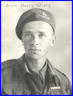
"In 1944 Uncle Henry Wiensz joined the Canadian Military Forces. After his training, the military transferred him overseas where he served at the front as a motorcycle dispatch rider in the liberation of Holland."
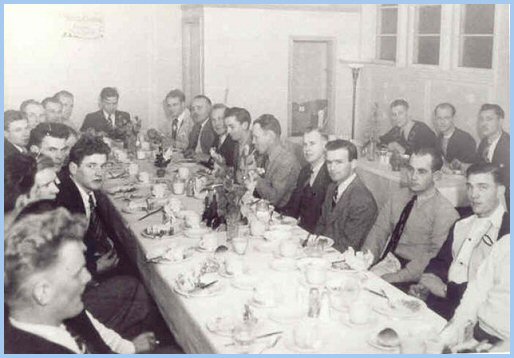
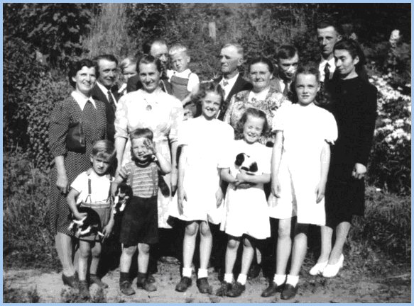
The extended Wiensz family enjoyed gathering at the Majuba Hill Farm for Sunday afternoon dinners, conversation and fellowship.
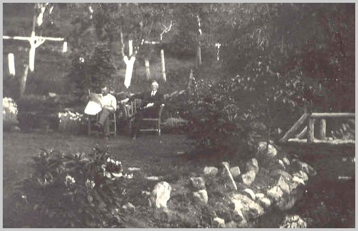
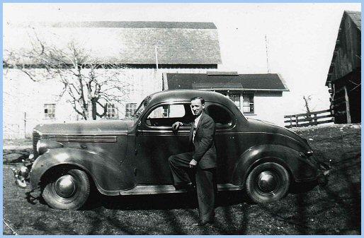
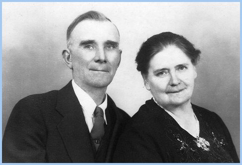
As a civilian again, Uncle Henry worked for many years for the Canadian Postal Service in Vancouver. The next picture shows Henry Wiensz visiting our grandparents, Maria and Peter Wiensz, with his new Ford Coop.
In the background, one sees Grandfather's cow barn, and the original barn overlooking Yarrow Proper on the plain below Vedder Mountain. Peter and Nettie Wiens' property lies due north on the slope between Grandfather's farm and the BCE Railway tracks, at the southern end of Ratzlaff Road. Elmer Wiens concludes, "In 1952 my grandparents sold their Majuba Farm to the Spenst family, and moved to Clearbrook, B.C. They purchased a house and acreage west of the Clearbrook MB Church on the north side of Old Yale Road. This fertile farm yielded superb crops of strawberries and raspberries, much to the delight of Uncle Alvin Wiensz."
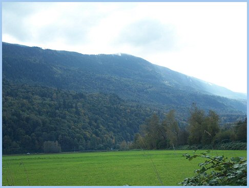
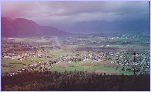
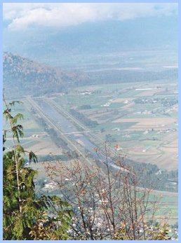
Vedder Mountain With its colourful, but often drab play of the seasons, Vedder Mountain was a steady physical and mental presence—it was always on ones mind. Like a colossal, Jurassic sturgeon deposited petrified by the receding Fraser glacier, it stretches from Switzer Creek at Vedder Crossing in the east, turning south at Arnold in the west into the U.S.A. toward Mount Baker. One necessarily grasps at a mountain's gestalt from a superfluity of distances and perspectives. To obtain the sense of a mountain's shape—its ascending pattern of thickets and grassy benches, densely tree-clad slopes, crags, and precipices—one must view the mountain from various locations, angles, distances, and directions.
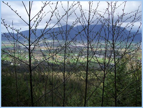
Similarly, one must climb the mountain to obtain the gestalt of its surroundings. Mid-way up Vedder Mountain lies the railroad bed built by the Vedder Logging Company during the early 1930's. From its vantage, one acquires a superb view of the village of Yarrow.
The trail leading up to the logging tracks offers a commanding view of Sumas Prairie and Sumas Mountain, screened through a copse of spring, pussy willows.
From Vedder Mountain's peak due south of Yarrow, one looks down to the north onto the Vedder Canal, Sumas Mountain, and the Fraser River, and down to the south onto Cultus Lake and Columbia Valley.
Completing the panorama, one looks through the haze east to Mount Cheam, and southwest across Columbia Valley to the mountains in the U.S.A.
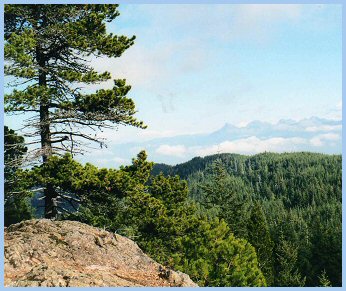
Vedder Mountain supports a second-growth rainforest, coveted by provincial foresters for its productiveness. A network of old logging roads and trails permits access to charming mountain locales to even the most casual, weekend hiker.
A turbulent stream, sparkling in the filtered sunshine, struggles through moss-covered roots, logs, and branches, dragged by gravity down its rock-strewn stream-bed.
Near the mountain's bottom, the stream disappears, consumed by a canyon chaotic with cedar, maples, salmonberry bushes, decadent mushrooms, lurking stinging nettle, and slippery ferns.
Pollution and global warming have reduced the numbers of frogs and toads indigenous to Vedder Mountain. Spotted frogs, Pacific tree frogs, Red-legged frogs, and Western toads inhabit the mountain's ponds, and streams, competing with introduced species such as Bullfrogs, and Green frogs. The trail from the Cultus Lake Highway to Vedder Mountain's peak goes by a small lake that was so well known for its large frog population, that it was tagged locally as Frog Shit Lake. Today this pond is a pristine alpine lake, with its clear water virtually free of frog egg clusters, tadpoles, and frogs.
| ||||||||||||||||||||||||||||||||||||||||||||||||||||||||||||||||||||||||||||||||||||||||||||||||||||||||||||||||||||||||||||||||||||||||||||||||||||||||||||||||||||||||||||||||||||||||||||||||||||||||||||||||||||||||||||


Works Cited and Consulted
|
Bigmore, Bill. Yarrow Pioneers: Text and Photographs. Private Communication, November, 2008. Brown, Chester. Yarrow Pioneers: Text and Photographs. Sydney, BC: Private Communication, August, 2008. Chilliwack Museum. Colonial Settlers. http://bcheritage.ca/chilliwack/history/settlers/index.htm Coutts, Cecil C. Cancelled with Pride: A History of Chilliwack Area Post Offices, 1865-1993. Abbotsford, BC: The Author, 1993. Giesbrecht, David. "Living East of Eden." Yarrow, British Columbia: Mennonite Promise: Village of Unsettled Yearnings. Ed. Leonard Neufeldt. Victoria, BC: Touchwood, 2002. 28-33. Harder, Esther. Yarrow Pioneers: Photographs. Private Communication, December, 2008 Harms, Kelly. "Before We Settled This Land." Yarrow, British Columbia: Mennonite Promise: Before We Were the Land's. Ed. Leonard Neufeldt. Victoria, BC: Touchwood, 2002. 91-108. Hudson, Gordon. Yarrow Pioneers: Photographs. Private Communication, August, 2008. Klassen, Agatha. E. Yarrow: A Portrait in Mosaic. Clearbrook, BC: Klassen, 1976. Lenzmann, Edwin. Yarrow Pioneers: Text. Winnipeg, Manitoba: Private Communication, October, 2008. Martens, Robert, Maryann Tjart Jantzen, and Harvey Neufeldt, eds. Windows to a Village: Life Studies of Yarrow Pioneers. Kitchener, Ont: Pandora, 2007. Neufeld, Elsie K., ed. Half in the Sun: Anthology of Mennonite Writing. Vancouver, BC: Ronsdale Press, 2006. Neufeldt, Leonard N., ed. Yarrow, British Columbia: Mennonite Promise: Before We Were the Land's. Victoria, BC: Touchwood, 2002. Neufeldt, Leonard N., ed. Yarrow, British Columbia: Mennonite Promise: Village of Unsettled Yearnings. Victoria, BC: Touchwood, 2002. Neufeldt, Leonard, with Arthur Block and Jack Derksen. "The Dynamics of Business in Yarrow." Yarrow, British Columbia: Mennonite Promise: Village of Unsettled Yearnings. Ed. Leonard Neufeldt. Victoria, BC: Touchwood, 2002. 148-64. Neufeldt, Harvey, Ruth Derksen Siemens, and Robert Martens, eds. First Nations and First Settlers in the Fraser Valley. Kitchener, Ont: Pandora, 2004. Neufeldt, Harvey. "Henry Sukkau: Yarrow's 'Mr. Fix It'." Eds. Robert Martens, et al. Windows to a Village: Life Studies of Yarrow Pioneers. Kitchener, Ont: Pandora, 2007. 151-67. Parker, Frank. Yarrow Pioneers: Photographs. Private Communication, September, 2008. Parker, Ray. Yarrow Pioneers: Text and Photographs. Coquitlam, BC: Private Communication, November, 2008. Siemens, Ruth Derksen. "'Pick the Berries, Don't Paint Them': The Odyssey of Three Mennonite Artists in a Mennonite Lotus Land." Yarrow, British Columbia: Mennonite Promise: Village of Unsettled Yearnings. Ed. Leonard Neufeldt. Victoria, BC: Touchwood, 2002. 130-139. Sleigh, Daphne. One foot on the border: a history of Sumas Prairie & Area. Deroche, BC: Sumas Prairie & Area Historical Society, 1999. Toews, Paul. Bridging Troubled Waters: Mennonite Brethren at Mid-century : Essays and Autobiographies. Kindred Productions, 1995. Wiens, Victor D. et al. Our Wiensz Heritage. Altona, Manitoba: Friesen, 1980. Wiensz, Theodore. Wiensz Family Photographs. Swift Current, Saskatchewan: Private Communication, June 2007. |
Do you have any old photographs of Yarrow: work, school, people, activities, sporting events, or whatever?
If you send a copy to the address below, I will put them on this web page.
|
Elmer Wiens |
Go to the homepage of Pat and Elmer.

